Great news – Banyule is developing a No Local Species Extinction plan!

You may have seen a request from Banyule City Council’s (Council) biodiversity team for community group input into the No Local Extinction Plan they are developing. This is the first action plan of its kind locally and is a fantastic initiative to attempt to retain as many of our indigenous species as possible.
Council have identified six key species which they will track and use as indicators of biodiversity health in the region. The species are:
- Powerful Owl (Ninox strenua)
- Eltham Copper Butterfly (Paralucia pyrodiscus lucida)
- Swift Parrot (Lathamus discolor)
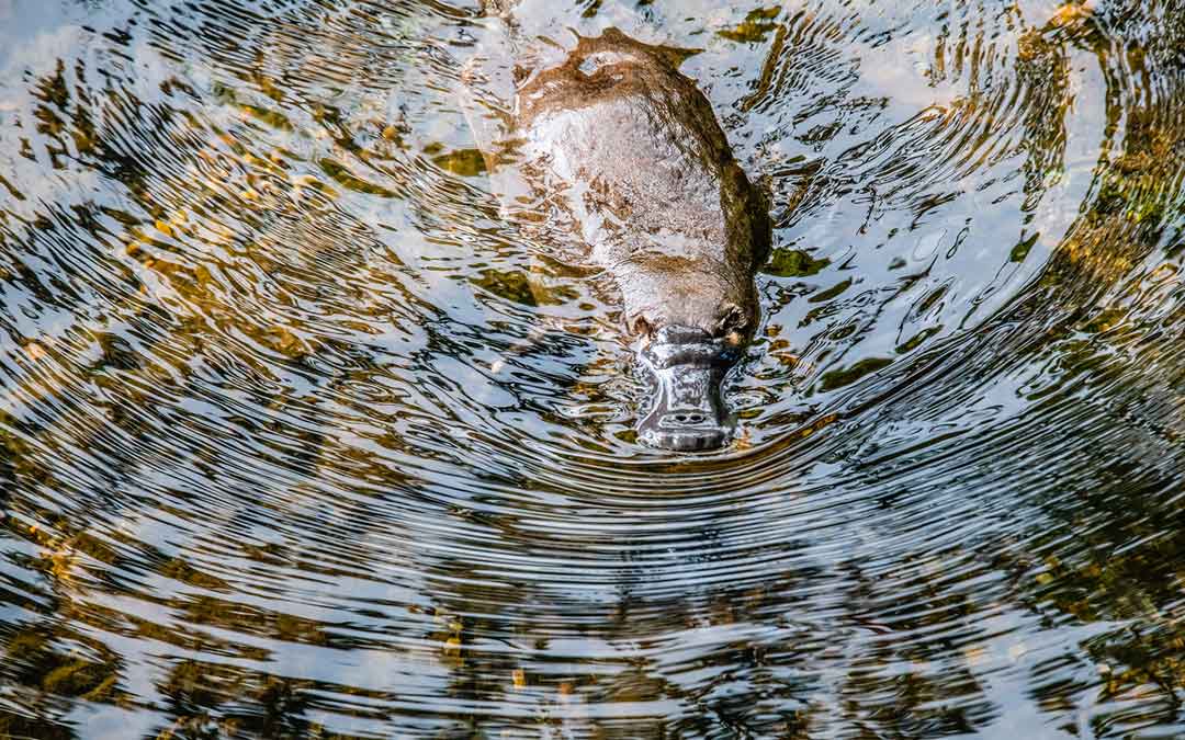
- Platypus (Ornithorhynchus anatinus)
- Krefft’s Glider (Petaurus notatus) – previously known as Sugar Glider (Petaurus breviceps), which has recently been split into three subspecies
- Growling Grass Frog (Litoria raniformis).
Jen Willis interviewed Banyule’s biodiversity adviser, Paul Davis, about the action plan’s development. This month features the first part of the interview. Stay tuned for the second part next month.
Could you give me a bit of background about how this project came to be and why it’s important Council develops this plan?
For a long time we have known about the different species present in Banyule – through our dedicated environmental community groups, in-house conservation teams and the community generally. But there was an identified gap in our knowledge about where specifically these species were throughout the municipality, the current state of their habitats and where we can make improvements. While this plan is being developed for Banyule City Council, it also acknowledges the importance of engaging with surrounding Councils and other stakeholders. The plan will highlight the current habitat for each species, areas of potential improvements and connection possibilities within Banyule and its surrounding local government areas.
As a point of interest, Darebin, Nillumbik and Manningham Councils have all already contributed to the local observations. Local plants and animals don’t live by local government borders and it’s important to consider that when developing a plan like this.
Please explain what the term ‘indicator species’ means.
Indicator species are generally species that serve as a measure of the environmental conditions that exist in a given location. The species highlighted, cover the widest range of habitats possible in Banyule where the species health themselves and can be representative of the general environmental health within Banyule and the surrounding areas.
How were these six species chosen?
The six species were chosen for their current vulnerability levels (at a local, state and federal level) in an urban environment and for the fact that their supporting habitats cover the largest span of Banyule’s current vegetation communities. They were also chosen for the stories that can be formed around them and be used as a visual representation as to why overall environmental protection and enhancement is possible.
There are no flora species included, could you please explain why?
We chose to go with fauna fairly deliberately and for the simple fact that most people relate easily with an animal. They are essentially used as a flagship or hook to discuss the overall environmental benefits when these species are protected. At the same time, the species in this plan and their supporting habitats encompass many (if not all) of the known threatened plant species in Banyule and therefore will essentially be covered when we refer to habitat protection and enhancement. We want to use these species as totems for overall awareness and champions of environmental protection.
Why is this plan important?
This plan is important as it will:
- highlight areas of importance for these six species and use this for strategic environmental planning opportunities;
- give Council a better understanding around current habitat and habitat potential;
- ensure that important habitats are considered municipality wide and protected;
- highlight how the community can engage with these species and identify future workshops and educational programs Council can facilitate; and
- highlight ongoing monitoring programs to ensure these species remain at healthy levels around Banyule and surrounding municipalities.
Could you provide an overview of the main stages of the project?
We recently engaged an ecology consultant, Ecology Australia, to develop the technical report for each of the species. This included gathering observations from a range of sources, including from the community.
Future stages will include:
- Community engagement portion to see what the community would like to see out of an action plan like this
- Consultation phase with stakeholders to develop actions for the plan
- Development of the plan
- Back to the stakeholders (including the community) for comments
- Adjust and finalise plan.
Will there be any further steps that residents can be involved in? Will the plan be made public?
The plan will definitely be made public as ongoing community support will be a key part to the overall success of the Action Plan. The idea is that we will develop a central recording space that collects the monitoring data from the species and then annually report on to Council and the community through the State of the Environment Report. I’m hoping that the community will be highly engaged in this space.
What can residents do to support the plan?
To support the plan, the community can engage with it directly by providing feedback and comments through the consultation phases (to come) via our Shaping Banyule page, where it will appear. The link provided will get you to the Shaping Banyule page where the community can find all current projects of interest on all projects that Banyule puts out for public comment.
Written by Jen Willis
